City of Peoria Landscape Intelligence Project
Communities across the Southwest face increasing pressure to conserve water while maintaining healthy, resilient landscapes. Traditional field inspections are expensive, time-consuming, and often provide only a limited snapshot of current conditions.
The City of Peoria partnered with Earth Systems to demonstrate how artificial intelligence and remote sensing can transform citywide landscape management.
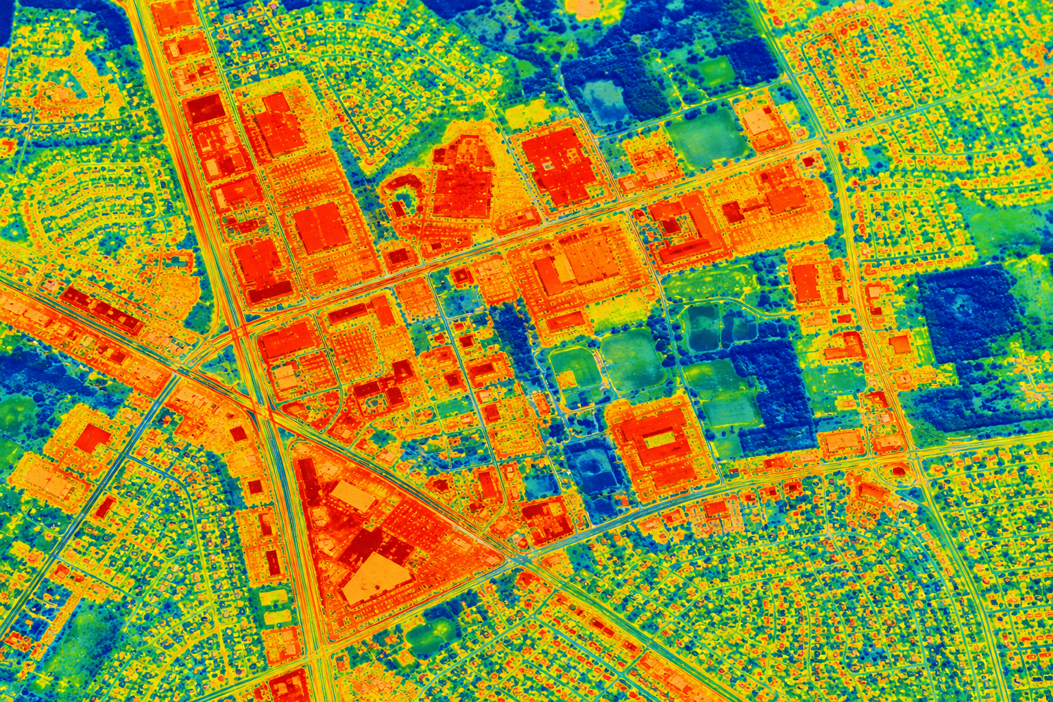
Using high-resolution aerial imagery, thermal data, GIS, and machine learning, Earth Systems analyzed every developed parcel in the city to identify irrigation opportunities, landscape composition, urban heat patterns, and long-term landscape change.
Prioritizing Conservation Investments
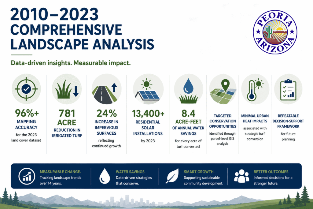
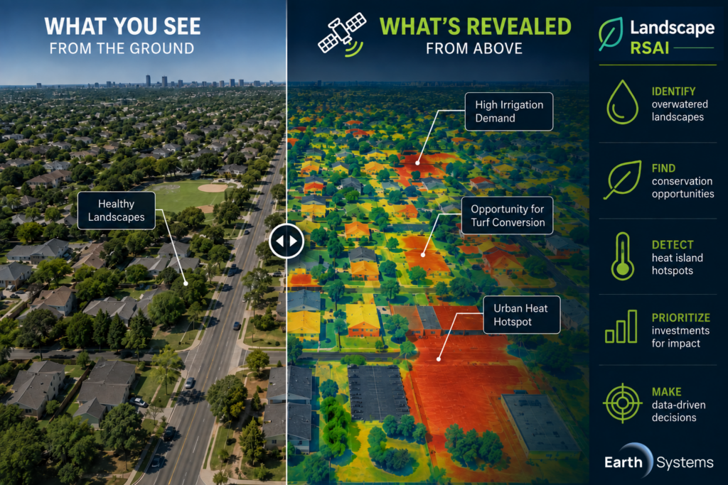
Rather than treating every property equally, Earth Systems developed analytics to identify where conservation efforts would produce the greatest return.
The City can now prioritize:
- High irrigation demand landscapes
- Commercial properties
- Institutional campuses
- Neighborhood hotspots
- Areas suitable for turf conversion
- Locations with elevated urban heat
This allows conservation funding to be directed where it creates the greatest measurable impact.
Monitoring Change Over Time
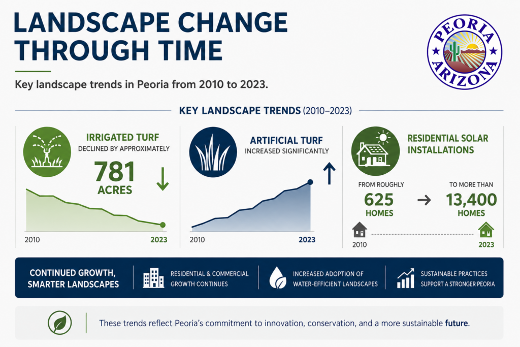
The project established a repeatable workflow that allows future imagery to be processed using the same AI models.
This enables the City to:
- Measure conservation program success
- Monitor development
- Track landscape changes
- Evaluate drought response
- Update planning datasets
- Report measurable progress
The Future of Municipal Landscape Intelligence
Artificial intelligence is changing how communities manage water resources. By combining AI, remote sensing, and GIS, municipalities can move beyond reactive inspections and begin making proactive, data-driven decisions that conserve water, improve resilience, and maximize public investment.
Ready to See Your Community Differently?
Earth Systems can help your community identify water-saving opportunities, improve landscape management, and build a more resilient future through AI-powered geospatial analytics.